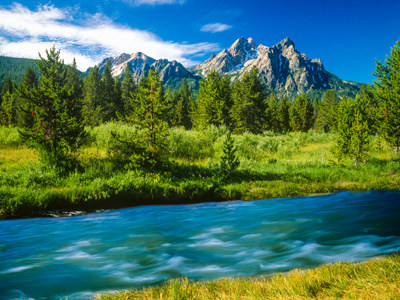
When studying landforms, geologists will look at specific characteristics. These characteristics include the land’s structure, its process, its slope and its drainage.
Structure: The structure of a landform includes the materials that are part of the land and how the materials are arranged in the land. As an example, a mountain can be made up of granite, sandstone, copper or other materials. Now, is that material lying horizontally, vertically or in some other configuration?
Process: The process is related to the forces that were involved in creating the landform. The processes can include weather, water, wind, pressure, moving ice, earthquakes, etc. Virtually all landforms are in a constant state of change and are constantly being impacted by a “process.”
Slope: The slope of the landform, or its steepness, helps geologists discover clues about the land’s formation and structure. In addition, the slope will influence how the landform continues to evolve.
Drainage: Although some might believe this would be part of the process, it is different because it has its own influential impact upon land. Most notably is the speed in which drainage takes place. The speed of drainage directly influences the shape and evolution of the landform in a manner different from that of the process.
TYPES OF LANDFORMS
There are many different types of landforms. Among them are:
Altitude – The altitude is the height of land that rises above the sea level.
Archipelago – The Archipelago is a group of islands.
Basin – A basin is an area of land that is enclosed by higher land (not to be confused with a valley).
Bay – A bay is a body of salt water that reaches inland and is generally a small section of a gulf.
Branch – A branch is a river or a stream that flows into a larger river or larger stream.
Canal – A canal is a man-made waterway that connects two bodies of water.
Canyon – A canyon is a narrow valley with steep sides. It is usually created through the process of erosion.
Cape – A cape is a curved piece of land that jets out into a body of water.
Channel – A channel is a narrow, yet deep, waterway connecting two larger bodies of water.
Cliff – A cliff is a high, steep slope of rocks and/or soil.
Continent – A continent is the largest body of land on Earth.
Continental Shelf– The continental shelf is a plateau of land found underwater.
Delta – A delta is land that has been built up by deposit of sand and silt at the mouth of a river.
Desert – A desert is a dry, barren region. It usually consists of some sand, has very little rainfall and rarely ever has any trees.
Divide – A divide is the highest ridge of land that separates river basins.
Forest– A forest is a large area of land that is covered with trees and underbrush.
Glacier – A glacier is a large body of slow moving ice which alters the land around it.
Highland – A highland is an area of hills, plateaus and mountains.
Island – An island is a piece of land that is completely surrounded by water.
Prairie – A prairie is a large region with tall grass.
Swamp – A swamp is an area of land that is always soaked by water.
Valley – A valley is low land between hills or mountains.
This quiz has been designed to see if you understand and, more importantly, recognize the different types of landforms that can be found on the planet. So take a look at the following questions and see if you can determine the correct landform for each one without reviewing this introduction. Take a moment or two to study the landforms and when you are ready, proceed to the quiz.


