UKUK USUSIndiaIndia

Every Question Helps You Learn

Join Us
Streak
Leading Streak Today
Your Streak Today
Streak
Leading Streak Today
Your Streak Today
O. S. Maps 03
What does FB stand for on an O.S. map?

O. S. Maps 03

This KS3 Geography quiz looks at O.S. maps. In 1995, Ordnance Survey digitised the last of about 230,000 maps, making the United Kingdom the first country in the world to complete a programme of large-scale electronic mapping. A big advantage of digital maps is that they can be updated more easily and more often than paper printed maps.

Many people rely on GPS to navigate, however, when the signal is poor or the system breaks down, knowing how to navigate using an O.S. map is very useful. O.S. maps have very fine blue lines marked on them marking out a grid. These grid lines are also numbered. The vertical lines are called the eastings because the numbers increase as you move further east on a map. The horizontal lines are the northings. Each grid square on an O.S. map represents an area on the ground of 1km2.

1 .
O.S. map grid squares are always equal to what?
Four kilometres squared
Half a kilometre squared
One kilometre squared
Two kilometres squared
On larger scale maps the grid lines are therefore further apart
2 .
If a compass was a clock, what direction is at 5 o'clock?
East North East
North East
South South East
South South West
Make sure that you learn how to combine the four cardinal directions of a compass - it is a very useful life skill
3 .
The 0° line of longitude is the Greenwich…what?
Marillion
Median
Medium
Meridian
So called because it passes through Greenwich in London. It was chosen as the international standard meridian in 1884 and since then has been the reference point for international time and longitude
4 .
A small flag on an O.S. map indicates what?
A burial ground
A castle
A golf course
Army barracks
The flag represents the flags on a golf course that show the golfers where they need to aim
5 .
What does FB mean on an O.S. map?
Farm Boundary
Fire Brigade
Fishing Banned
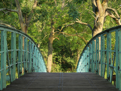
Footbridge
It may be over a waterway, road or railway
6 .
How is 'cemetery' usually abbreviated on O.S. maps?
Cemy
Cmy
Cty
Cy
The shape of the cemetery is drawn alongside it on the map
7 .
A map showing height and shape of land using different colours is called a what?
Altitude map
Hill map
Landscape map
Relief map
O.S. maps are not relief maps but they do show land height and shape by using contours
8 .
What are vertical grid lines on a map called?
Eastings
Northings
Southings
Westings
Their grid numbers get bigger in an easterly direction
9 .
Which statement is true about contour lines?
They are sometimes blue
They are straight
They do not have the height written on them
They never cross
They join points of equal height. They can be very close together on a map but they can never cross
10 .
On O.S. maps what colour are main roads?
Black
Green
Red
Yellow
There are several different classes of road in the UK and each has a different symbol on the map
You can find more about this topic by visiting BBC Bitesize - Map symbols, direction and contour lines

Author:  Jan Crompton

© Copyright 2016-2024 - Education Quizzes
Work Innovate Ltd - Design | Development | Marketing