


Ask the AI Tutor
Need help with Europe - Physical Geography 01? Ask our AI Tutor!
AI Tutor - Lucy
Connecting with Tutor...
Please wait while we establish connection
Which river does Paris stand on?
Europe - Physical Geography 01
From icy Arctic seas to warm Mediterranean coasts, Europe’s physical geography includes mountains, rivers, plains and plate boundaries that shape weather, landscapes and how people live.
1 .
The Pyrenees are mountains separating which two countries?
France and Germany
France and Spain
Germany and Austria
Spain and Portugal
The republic of Andorra lies within the Pyrenees
2 .
Norway, Sweden and Denmark are part of which region?
Iberia
Scandinavia
The Low Countries
The Ruhr
Scandanavia is a peninsula
3 .
The highest mountain in the Alps has what name?
Mont Blanc
Mont Noir
Mont Rouge
Mont Vert
It is the third highest mountain in Europe
4 .
Which country would you visit to see fjords?
Austria
Netherlands
Norway
Ukraine
A long, deep sea inlet - a submerged glaciated valley
5 .
The Massif Central is a mountain range in which country?
Belgium
Denmark
France
Greece
It is the remains of an older mountain range and had active volcanoes until about 6,000 years ago. Technically, these volcanoes are dormant but it is not expected that they will ever erupt again
6 .
Europe is best described by which word?
Country
Island
Peninsula
Republic
A peninsula is surrounded by water on three sides
7 .
Which are the highest mountains in Europe?
Alps
Balkans
Pyrenees
Urals
Even though the highest point of Europe is not in the Alps, overall they have the greatest average height
8 .
Which city does not lie on the River Danube?
Belgrade
Budapest
Stockholm
Vienna
Stockholm is built on fourteen islands where Lake Mälaren meets the Baltic Sea
9 .
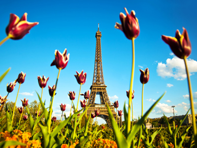
Paris stands on which river?
Garonne
Loire
Rhone
Seine
The River Seine is officially 777 km long
10 .
Europe is separated from North Africa by which sea?
Mediterranean Sea
North Sea
Pacific Ocean
Red Sea
The Mediterranean Sea is classed as being non-tidal. There are actually tides in the Mediterranean Sea, but the difference between high and low tide is so small in most areas that people don't notice


**Unlimited Quizzes Await You! 🚀**
Hey there, quiz champ! 🌟 You've already tackled today's free questions.
Ready for more?
Ready for more?
🔓 Unlock UNLIMITED Quizzes and challenge yourself every day. But that's
not all...
not all...
🔥 As a Subscriber you can join our thrilling "Daily Streak" against other
quizzers. Try to win a coveted spot on our Hall of Fame Page.
quizzers. Try to win a coveted spot on our Hall of Fame Page.
Don't miss out! Join us now and keep the fun rolling. 🎉
**Unlimited Quizzes Await You! 🚀**
Hey there, quiz champ! 🌟 You've already tackled today's free questions. Ready for more?
🔓 Unlock UNLIMITED Quizzes and challenge yourself every day. But that's not all...
🔥 As a Subscriber you can join our thrilling "Daily Streak" against other quizzers. Try to win a coveted spot on our Hall of Fame Page.
Don't miss out! Join us now and keep the fun rolling. 🎉
© Copyright 2016-2026 - Education Quizzes
Work Innovate Ltd - Design | Development |
Marketing